Crew Log for February 17th, 2023
Trip Summary:
• Black Point to Shroud Cay
• Trip Distance of 36.4 NM, Total Distance To-Date of 2,968.6 NM
• Departed at 08h30, arrived at 15h45
There is an old sailing expression, that I’ll butcher, that goes something like, “…the worst plan is sailing with a plan…”. Over the years, and during this trip, whenever we stuck to a plan, when we knew we shouldn’t have, things went wrong. Our departure from Charleston springs to mind. Conversely, whenever we changed our plan, based on new information, things generally went better than expected. Our trip across the Bay of Fundy is a good example.
We’d been watching the weather forecasts and talking to different people about suitable conditions to make the jump from the Exuma Cays to Eleuthera. A 50 nautical mile “hop”.
For those of you unfamiliar with the geography of the Bahamas, it is a nation consisting of more than 3,000 islands, cays, and islets in the Atlantic Ocean, spread across 13,878 km2 (5,358 sq mi), 28 percent of which is covered in water. The Royal Bahamas Defence Force describes The Bahamas' territory as encompassing 470,000 km2 (180,000 sq mi) of ocean space.
Since arriving on New Year’s Day, we have visited Grand Bahama, the Berry Islands and Exuma. The Berry Islands consist of over 130 islands and cays, and Exuma has more than 365 individual islands and cays, so we have barely scratched the surface in the little over a month and half we’ve been here. The diversity from one area to another is amazing, ranging from modern commercial centers to uninhabited islands.
We naively thought that once we crossed the gulf stream, our worries associated with long open water passages were over until we returned at the end of March. We quickly found out however, that that the distance between the major island chains, is almost as great as the distance between Florida and the Bahamas.
Our challenges were clear. Given we only travel at an average of 5.5 knots per hour, we had to limit the crossing distance to 50 nautical miles or less. We didn’t want to cross at night, given the depths can literally go from thousands of feet to less than ten feet in a short distance. Negotiating the cuts could really only be done with good daylight visibility in order to avoid coral heads or other hazards. We also wanted to time our transit through the cuts to be as close to slack tide as possible to avoid the potential of wind against tide creating stacked waves.
Aside from that, we and Elizabeth M, are most comfortable on a beam reach (winds to the side) or a slight broad reach (wind on the stern quarter) in winds ranging from 10 – 15 knots, with occasional gusts to 20 knots. Oh yes, and we like nice, sunny weather. Just kidding, but you get the point, the conditions for a safe comfortable passage are fairly specific.
Despite what I said earlier about a “plan”, our rough schedule was to be in the Abaco Islands by the first part of March, which would give us roughly a month there before heading back to the States. However, before we got to the Abacos, we would need to cross to Eleuthera from the Exumas. We determined the best place for us to cross was from Shroud Cay, which would keep our trip to Rock Sound under 50 nautical miles.
The forecasted wind for the following day was out of the south – south west, but was expected to diminish through the day. If we were lucky, we would have a broad reach in relatively calm seas. So, with all this information, we decided, it was time to go, which meant we were heading to Shroud Cay today, to stage for our crossing on Saturday.

We had a straight downwind sail for most of the day, which is not ideal for us, but it was a comfortable sail. Sensai had left earlier in morning and planned to connect with folks from their sailing club back home who were chartering a friend’s boat for a couple of weeks. We hadn’t told them we were leaving since we didn’t know ourselves until after they left, and we never did catch up to them. We’re guessing they were motoring in order to top up their batteries, which they seemed to having some trouble with.
We arrived in Shroud shortly before 4 pm and the mooring field was almost full. We did eventually find a mooring that we assume was for larger boats since the mooring pendants were as big as my arm. The horizon was dotted with large Super Yachts, anchored in the deeper (relatively speaking), water. Judy spotted a tiny little beach on the island, so we dropped the dinghy in the water and went over for a swim and a “Dawn” bath.

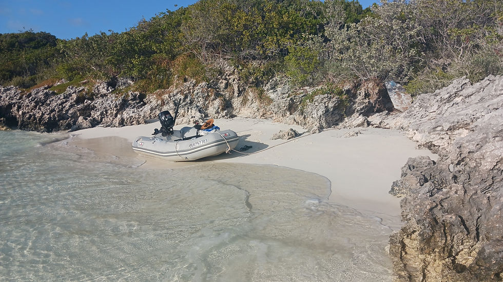

Since we don’t have access to marina showers and we have limited fresh water capacity, we generally “shower” in salt water, followed by a limited fresh water rinse. Dawn or Joy dish detergent seems to work pretty well in the salt water. Besides, I love the looks I get when I tell someone I took a bath with “Dawn” or “Joy”. We enjoyed our own little private paradise in the Exumas for the last time, before heading back to prep the boat and ourselves for the crossing in the morning.
Little did we know, but the Exumas had one last test of our seamanship before we were finished with this region of the Bahamas.
But more about that, next time.
Additional Photos:

Comments